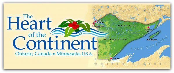
Making Reality into Perception
(Comments from Heart of the Continent map author Robin Reilly, Superintendent, Quetico Provincial Park)
The idea. There was no blinding flash moment that this map came together. Over the last five years there have been many initiatives that included elements from both sides of the border. Quetico PP, Superior NF, Voyageur NP and a host of smaller parks, reserves and historic sites all have much in common environmentally and historically. But time and time again one of the impediments to advancing these cross-border, cross boundary projects (e.g. forest fire research) was no common map. Minnesota maps tended to show Ontario as blank (or a good spot to stick legends and titles) and vice versa. So although in reality this international area was a vast mosaic of publicly managed green space, few thought of it that way. I’ve often repeated that the challenge of the map was to “Make reality into perception.” That is to say, to take what really existed and graphically portray it so that people began to think of it as an interconnected mosaic.
The map (with reverse side text) thus tries to depict the unity and the diversity of the public lands and situate them in the regional context. It also seeks to provide a source of contact information (mail, web, phone) for the entire area as well as a summary of where some of the best areas are for different kinds of recreation. There are already maps that to some extent provide cross-border information for driving, fishing and snowmobiling, so we chose to concentrate on human-powered recreation. We also chose to depict both natural and cultural areas.
The challenge. This wasn’t just an exercise in cutting and pasting; our respective countries use different scale, different datum reference points, different projections, different measurement units, different descriptive terms. In short we could not merge existing maps; we had to start fresh…and so it took several years and innumerable reviews.
In such a large and complex task there will be some mistakes. That’s why only 1000 copies of this first version were printed. We encourage people to provide input on corrections and improvements. We plan an updated version in six months time or so to be released in 2009 as part of celebrating the Quetico/Superior centennial.
Knitting the region together. While each of the pieces of land is important individually, they collectively provide a far more significant piece of environmental real estate. For example, the area of Voyageur National Park alone is likely far too small to sustain some wildlife populations into the future, but as a key piece of a larger landscape the prospects are more hopeful. Ideally the map helps people come to think and act with this in mind. Hopefully this map is just one Heart of the Continent initiative and others (posters, books, calendars, events etc) will evolve to further knit the region together.
