 Team name
The New City of Ranier
Project name
Create a Ranier-Centered Map
Location
Ranier, Minnesota
Team members
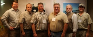
- Andy Hubley, Arrowhead Regional Development Commission, Director of the Regional Planning Division
- Dan Klocek, City of Ranier, City Council
- Edgar Oerichbauer, City of Ranier, Mayor
- Randy Pozniak, Citizen Committee for the Development of the New City of Ranier
- John Walls, City of Ranier, City Council
- Mike Ward, Voyageurs National Park, Superintendent
Project Summary (31 May 2012)
The Ranier Team has completed its primary goal that was developed at the community congress. Using monthly meetings and several phone calls, the Team designed a community map that shows Ranier and its important features, including parks, water accesses, trails, and businesses. The reverse side of the map shows the area surrounding Ranier, including Voyageurs National Park, Fort Frances, International Falls, and regional attractions, including museums, parks, and trails. The title of the map is Port of Ranier: Gateway to Voyageurs National Park and the Heart of the Continent. The Arrowhead Regional Development Commission provided the cartography, graphic design, and printing coordination. Other Team members provided location information, editing, photographs, distribution, and funding for printing. The Team has not yet met to discuss its next project…it may not restart until the fall.
s
In the news
Results tracker
Photos
Contact This Team: Andy Hubley
—————
Attn Team members: Send page updates to Bret Hesla at hocp@heartofthecontinent.org

